KoREA: The North and the DMZ
by littlesarahbigworld
Hey, Friends. Let me tell you a story. It’s about me having even more photos from the cabin to post. Are we sick of those yet? It’s about me making new friends and spending my evenings drinking, dancing, and listening to music, instead of at home, blogging. It’s about me working two jobs, Friends. Moral of the story? I haven’t been posting as often as I’d like. And now all of my cabin posts will not be in a row. Imperfections: How Sarah Learns to Deal With Them. That’s probably the title of the story.
Whitney, on the other hand, is on vacation! Lots of time! Lots of time to write long, interesting posts about world travel. No resentment here, Friends; she deserves it. So settle in with a cup–make that an entire pot–of tea for…another post from Whitney in Korea!
* * *
When I studied abroad in Paris (five years ago – wow!), one of my friends from the program was from Korea. I remember her trying to explain to us Americans how South Koreans viewed the North as she said, “We feel like they are our brothers and we want them to stop suffering”. That statement has always stuck with me and was one of my most revisited memories while touring the Demilitarized Zone last Saturday.
The Demilitarized Zone is an area of land that buffers the North/South border, cutting the Korean peninsula in half roughly along the 38th parallel. It runs about 250km long from coast to coast, is 4km wide and is heavily guarded. Much of it is fences and walls topped with barbed wire and speckled with guard posts looking into dense jungle, while the most famous section is called the Joint Security Area – a compound right on the demarcation line where North and South Korean officials hold meetings on “neutral” grounds. On a tour organized through Osan Air Base, Tim, Andrew, Daniel and I visited this area along with a few other stops, only taking pictures when told we were allowed to.
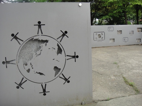
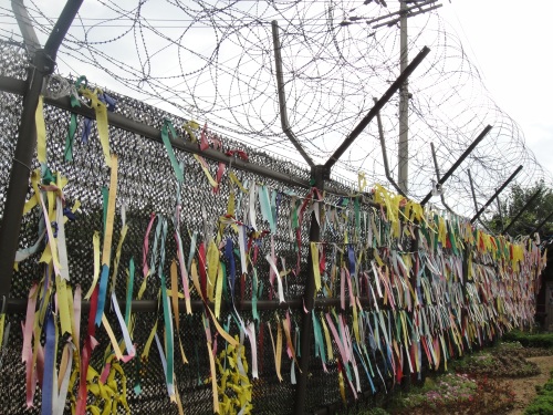
The first stop was Imjingak – a site with memorials dedicated to separated families, a place for displaced Koreans to pray and honor their ancestors, and the site of the “Bridge of Freedom”, built to return over 12,000 Korean War prisoners to the South (now only about 100ft long), everything expressing wishes for peace, healing and reunification.
The next stop was at a sort of military observation post, providing a brief opportunity to look out over the DMZ. From there we could see the only two towns that are located in the DMZ – the “Propaganda Village” in the North and “Freedom Village” in the South. Both have tall towers that fly huge national flags, waving them in each others’ faces. We were not allowed to take photos here, but I have a decent one of the Propaganda Village from later in the tour. From there we went to another location where we weren’t allowed to bring cameras: one of the four known tunnels that North Korea has dug underneath the DMZ. Tunnel #3, which we visited, was the largest of the four – large enough to allow 30,000 fully armed North Korean troops to pass through in the space of an hour, should they use that tactic to invade. We stowed our cameras, donned hard hats, and marched down a 30% incline to reach an opening to the rock-carved tunnel. North Korea ordered the tunnel walls to be covered with coal dust so that when it was discovered by the South in 1978 (thanks to a tip from a North Korean defector), North Korea could claim the tunnel was actually a mine shaft: a 1,635 meter mine shaft that happened to pass under the DMZ. Some of the dynamite scars show that North Korea was intentionally directing their missive toward the South.
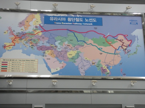
After the tunnel we came to the northernmost train station in South Korea: Dorasan. This station was built to connect the Korean Peninsula to the rest of the continent’s rail system; running through North Korea, the network eventually reaches Western Europe.
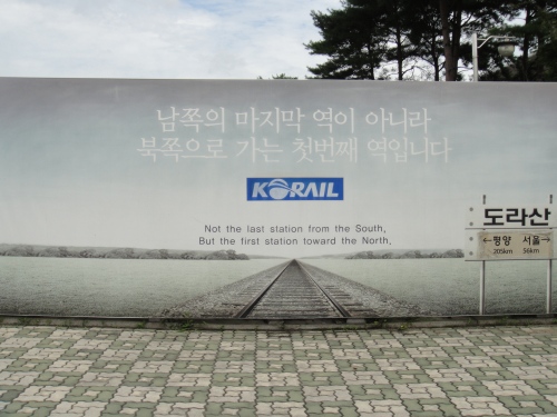
North Korea allowed this train to run, one symbolic time about ten years ago, from Dorasan to Pyeongyang and back again. The station now sits empty but for the occasional burst of people armed with cameras deploying from tour buses. We paid 500 won each (about 50 cents) for a ticket to the platform where we took pictures of ourselves casually lying down on the tracks and made half-hearted jokes about running away from a Northbound train, knowing that such a train is not likely to run for decades to come. This giant advertisement from Korail, the Korean railway company, expressed a sort of obligatory hope that the station was not constructed in vain. Note: the small sign pictured in the bottom right corner of the ad indicates that Pyeongyang is 205km away and Seoul is 56km in the opposite direction.
After Dorasan Station we had lunch and were then driven to the trip’s highlight: the Joint Security Area. As I mentioned before, this is a heavily militarized compound straddling the border where the North and South hold political meetings. We were led by an American Army soldier who told us when we were and were not allowed to take pictures. The photo below shows the blue buildings (considered neutral territory) where meetings are held, as well as some of the People’s Republic of Korea (North Korea) buildings, the three gray ones in the center and on the right. The biggest gray building, in the center on the far side, had two brown-clad North Korean soldiers peering at us through binoculars – one standing on the top step just outside of the doors, and one inside on the ground floor. The soldier leading our tour said the one inside was scanning our faces to make sure that none of us were politically important peoples or celebrities disguised as tourists. He also told us that North Korea conducts about 1 tour of the JSA to every 10 tours on the South Korean side.

The Joint Security Area: blue buildings are where meetings are held; the three gray buildings here are North Korean owned.
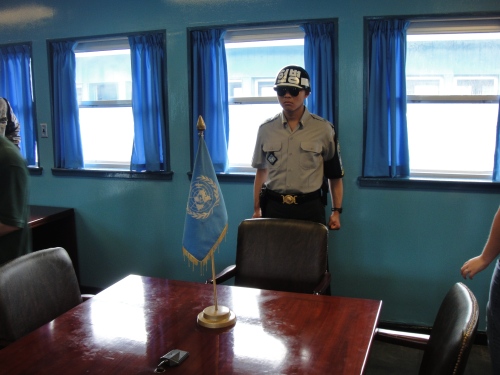
Because we were being watched so closely, we were instructed not to make any gestures whatsoever toward North Korea or its soldiers so as to give them as little material as possible to be used as propaganda against South Korea and the United Nations Command. We had the opportunity to enter the blue building that you see above (the one with the door open) and see the table where diplomats meet (and conduct “bladder wars”, where no one gets up from the table for hours and hours). We were told that no meetings have been held there for some time. The Republic of Korea’s soldiers (ROK = South Korea) are standing in a modified taekwondo position that allows them to react quickly if necessary and also looks tough. This stance is known as “ROK Ready”. The soldiers positioned halfway between a building and an open corridor are placed so because it allows them to duck and cover quickly, or signal with their hidden hand without being seen from the North Korean side if they see something unusual.
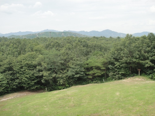
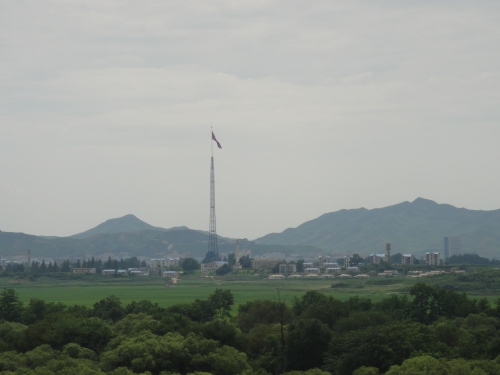
That’s right, I stepped to the North Korean side of the table with everyone else, when instructed we could. I was in North Korea for about three minutes. Then we left the building and took to the bus once again for a drive through the JSA. We stopped at a checkpoint where we were only about 100ft from the border (the white posts in the picture below), and just a couple kilometers away from Propaganda Village (the picture below that):
Propaganda Village, most recognized by its humongous, 31 meter-long, 600 pound (when dry) flag, has no real inhabitants. The buildings mostly exist to show how “well” North Korea is doing, however, when lit (a rare occasion), the light is brightest at the top “floor”, and becomes gradually less bright in the windows below, showing that there are no walls or even floors within the buildings, as they were not made to actually have people in them. Sometimes people are seen in the city, mostly to raise and lower the gigantic flag. I didn’t hear how many people that requires.
Propaganda Village is countered by South Korea’s Freedom Village, of which I have no pictures because when we drove by, we were in a “no photography” zone. It has a tower similar to the one pictured above, flying the South Korean flag. It also has actual inhabitants who make their living by farming; as many as 17 acres per farm in this area compared with the 1-4 acres in many other regions of Korea means for a greater yield and pretty decent money – especially because the government buys the crops that don’t sell. That incentive, along with a government subsidy, means residents make at least $80,000 per year. Not bad living, as the residents are exempt from taxes and conscription, but the town also has serious restrictions. Residents must be direct descendants of people who lived in that valley before the Korean war, only women can marry in, and everyone has to obey a strict curfew and be present in the town for a certain number of days per year. (Reminds me of Alaska and the PFD in some ways.)
The drive back from the checkpoint concluded our tour of the DMZ. We saw most of what there was to see (for the public, anyway), and most of what we didn’t see, I imagine, looked like jungle. The cool thing about the DMZ is that, as it has been basically untouched by man since the end of the Korean War in 1953, it is essentially a 60 year-old wildlife preserve.
The most mind-blowing aspect of the day was how close we were to such an oppressed nation. Propaganda abounds on both sides of the border; South Korea directs balloons toward the North that are filled with candy, American dollars, and pamphlets criticizing Kim Jong Il along with news of world events. This sort of propaganda speaks, in essence, of the truth. Propaganda from North Korea to its own citizens demonizes the United States, portrays the South Korean government as puppets of the West, strongly emphasizes the property of “juche” (North Korean independence and self-reliance), and places North Korea at the center of world events. Its military is strong but its people are starving; any money earned (whether by legal or illegal means) and most of the humanitarian aid received goes to bolstering its military forces while very little is used to help its citizens. An NPR article I recently listened to pointed out that Kim Jong Il is concerned not with building a healthy country with a successful economy, but with maintaining control of the populous.
Tim and I agree that we don’t expect to see much change in political relations on the Korean Peninsula during our lifetime. My Korean friend’s description of how the South beholds the North will be with me, it seems, for a while.

[…] Visit link: KoREA: The North and the DMZ « little sarah Big World […]
Something I heard recently (yeah, NPR…) – the Democratic Peoples Republic of Korea advertises itself as the “Second happiest nation in the world.” No word on who’s first.
Probably one of those 90% of statistics that are made up on the spot…
I thought the first was Bhutan…